
Itinerary 2: Coll's Mountain
*** SIGNAL PENDING ***
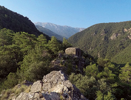
This route, which passes through the municipality of Arsèguel, begins in the square of the church of Santa Coloma, within the boundaries of the village. Then, it descends in the direction of the Arsèguel river and continues southwards along a path with a descriptive plate at the beginning. You will cross the river through the tosca bridge, and then you will follow the yellow markings of this road, which, in some cases, cross the Ruta dels Búnquers (Bunkers Trail). In relation to this last route, the path allows you to visit two of the fortifications of the postwar period, which are built in high points on the left bank of the Segre river.
 |  | Moderate |
 | Arsèguel Leaving from the square of the Church | |
 | 6,8 km | |
 | +561 m | |
 | 2h15 | |
   | ||
|


For more information: turisme@alturgell.ddl.net